
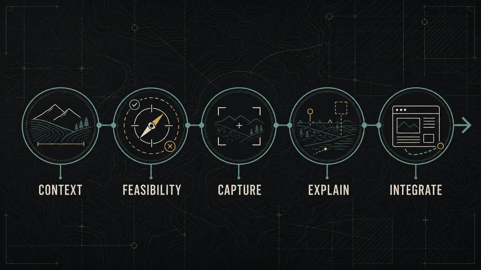
Drone footage is useful when the aerial viewpoint explains something the customer cannot understand as well from the ground.
That may be the scale of a property, the relationship between buildings and access points, progress across a large site, the setting around a destination, or the sequence of an outdoor operation.
A smooth flight alone is not a marketing strategy. If the angle does not clarify the offer, support a real page, or help someone make a decision, the business may be paying for spectacle rather than information.
Begin With the Question the Aerial View Must Answer
Define the customer question before discussing aircraft, resolution, or shot style.
Useful questions include:
- How large is the site or project?
- Where is the business in relation to a recognizable route or landmark?
- How do different areas of the property connect?
- What changed across a large outdoor space?
- What does arrival, access, parking, or circulation look like?
- How does a place feel in its real surroundings?
Write the answer the final page or video must communicate. Then decide whether an aerial view is the clearest evidence.
The reusable content shoot guide explains how to map destinations, viewer questions, formats, permissions, and shot families before capture.
Where Aerial Footage Can Add Real Value
Scale and layout
Ground-level images can make a large site feel fragmented. An aerial establishing view can show the relationship among buildings, work zones, landscape features, entrances, or completed areas.
Use labels or surrounding copy when the relationships are not obvious. Do not expect the viewer to infer the important point from motion alone.
Place and arrival
Hospitality, recreation, events, real estate, facilities, and service-area businesses may need to show how a location sits within its surroundings.
The useful edit may be a short arrival sequence, not a long cinematic reveal. Pair it with accurate directions, service information, or event details on the page.
Progress and comparison
Consistent viewpoints can document change across a site. The value depends on repeatable position, timing, framing, and honest labels.
Do not imply a before-and-after comparison when seasons, light, angle, or camera distance make the conditions materially different.
Access that is impractical from the ground
Some exterior features or large assets may be difficult to show clearly at eye level. Aerial capture can provide context, but it is not automatically an inspection and should not be presented as one unless the work, operator, and deliverable genuinely support that claim.
A visual opening
A short aerial clip can establish place before ground-level details explain the service or experience. It should hand off quickly to the information the customer needs.
When a Drone Is the Wrong Tool
Skip aerial capture when:
- a ground-level photograph explains the subject more clearly;
- the business needs human detail, sound, texture, or close process rather than scale;
- the site, airspace, people, traffic, weather, or surrounding conditions make the planned operation inappropriate;
- the required authorization, permission, time, or qualified operator is unavailable;
- privacy concerns outweigh the communication value;
- the final page has no room or reason for the footage;
- or the budget would produce more value by fixing the page, offer, copy, or customer path first.
The best production decision is sometimes not to fly.
Treat the Flight as an Operational Decision
In the United States, flying for work or business generally falls under the FAA’s Part 107 framework. The FAA states that a person operating the controls under Part 107 needs a Remote Pilot Certificate with a small UAS rating or must be under the direct supervision of someone who holds one. Review the current FAA guidance for certificated remote pilots and commercial operators.
This article is not legal or flight instruction. Requirements depend on the operation, aircraft, airspace, location, and current rules. The responsible operator must make the go/no-go decision.
Before approving a business shoot, identify:
- who is the responsible remote pilot;
- whether the intended operation fits the operator’s certificate, aircraft, and approvals;
- where takeoff, landing, and the flight path are proposed;
- what airspace or location restrictions apply;
- whether people, vehicles, structures, wildlife, events, or emergency activity affect the operation;
- who controls the property and grants site access;
- what weather and visibility limits govern the decision;
- and what happens if the operation cannot proceed.
The FAA’s Where Can I Fly? resources direct operators to current airspace and restriction information. A marketing deadline never overrides an operational limit.
Verify Registration and Remote ID
The FAA explains that drones used under Part 107 must be registered and that registered or registration-required drones must comply with Remote ID unless an applicable exception applies. Use the current FAA registration guidance and Remote ID information rather than relying on an old production checklist.
A business hiring an operator can request appropriate evidence of:
- remote pilot certification;
- aircraft registration;
- Remote ID compliance where required;
- insurance requested by the business or property owner;
- any needed authorization or waiver;
- and the planned operating boundaries.
Documentation does not make an unsafe plan safe. It establishes accountability and helps the business avoid building a campaign around an operation that cannot responsibly occur.
Plan Privacy and Property Boundaries
An aircraft can see beyond the intended subject. Identify nearby homes, people, license plates, private activity, sensitive facilities, and areas that should not be recorded or published.
The operator and business should agree on:
- the intended subject and geographic boundary;
- prohibited angles or adjacent areas;
- permission for identifiable people and private property;
- how incidental material will be handled;
- who reviews the footage before publication;
- and how long originals are retained.
Federal aviation compliance is not the only consideration. State and local laws, property rules, contracts, and privacy obligations may also apply. Obtain qualified guidance when the situation requires it.
Build a Shot Plan Around Evidence
Use a small set of purposeful shots.
| Need | Possible aerial treatment | Supporting material |
|---|---|---|
| Establish place | Brief wide reveal | Map, address, written directions |
| Explain layout | Stable high-angle overview | Labels or page copy |
| Show scale | Wide frame with recognizable reference | Ground-level details |
| Document progress | Repeatable viewpoint | Dates and scope notes |
| Introduce a project | Short establishing motion | Process and outcome sequence |
For every planned shot, record:
- the customer question;
- the subject;
- the intended movement or stable frame;
- the first publishing destination;
- required orientation and safe crop;
- what ground-level shot completes the explanation;
- and what would make the shot unusable.
Avoid collecting long, repetitive flights simply because storage is available.
Capture Ground-Level Context Too
Aerial footage is usually strongest as one layer of a visual story.
Pair it with:
- signs, entrances, and wayfinding;
- people carrying out real work with permission;
- medium process views;
- close details;
- ambient sound or a verified spoken explanation;
- and the next state or outcome.
The aerial view answers “where” or “how large.” Ground-level material often answers “what,” “how,” and “who.”
Integrate the Asset With the Page
Decide where the footage earns its place.
On a service page, use a short clip or still only if it helps explain fit, scope, place, or process. Add nearby text that identifies what the viewer is seeing and why it matters.
On a project page, document the date, conditions, location at an appropriate level, and the specific work shown. Keep claims proportional to the evidence.
On social channels, adapt one clear observation rather than publishing an unexplained montage. The local-business social media plan provides four useful lanes: Explain, Answer, Show, and Invite.
Provide a poster image, captions or transcript where spoken information matters, and an accessible alternative for information communicated only visually. Do not autoplay a large background video at the expense of page speed, readability, or user control.
Measure the Business Path
Do not evaluate aerial footage only by views.
Choose the action the supporting page is intended to help:
- reaching the correct location or event information;
- visiting a service or project page;
- understanding property or project scope;
- submitting a qualified inquiry;
- or advancing a sales conversation.
Then review diagnostic signals such as video engagement, page movement, recurring questions, and the usefulness of still frames across later materials.
The footage succeeds when it improves understanding or evidence. It does not need to become the visual identity of every page.
A Hypothetical Example
Consider a destination business whose customers regularly ask about arrival, parking, and the relationship between the main building and an outdoor activity area.
The useful plan is not a two-minute cinematic flight. It is:
- one brief establishing view;
- one stable layout view;
- ground-level arrival and signage details;
- accurate written directions;
- a page section answering the common questions;
- and a short channel-specific update linking to that page.
If the operator cannot complete the aerial portion responsibly, the ground-level sequence and map can still answer the questions. The campaign does not collapse because the flight has a contingency.
The Bottom Line
Drone footage earns its place in small-business marketing when the aerial perspective adds information: scale, layout, place, access, or progress.
Start with the customer question. Verify feasibility with a qualified operator. Respect airspace, registration, Remote ID, property, privacy, weather, and site constraints. Capture supporting ground-level evidence. Then place the final asset where it helps a person understand the business and take a sensible next step.
Dark Monkey Media approaches aerial material as one component of content systems and digital operations, not as a substitute for them. If the website cannot explain what the footage is meant to support, clarify the customer path before adding production.